Terraced Landscape of the Mediterranean Plateaus
Agricultural terraces are among the most recognisable of man-made landscape elements, which mankind has built-up gradually in adapting to the natural conditions and improving the chances of survival. Terracing has facilitated cultivation, enabled intensification, reduced water and wind erosion, increased and retained soil moisture, and gained land at the same time. Terraced landscapes have been used in different corners of the world, combining and advancing the knowledge of previous centuries and even millennia, and continue to be built today. Among the older terraced landscapes, from the period before antiquity, are those in the hinterland of the Mediterranean Sea. From there the terraces spread into the interior of the continent, also into the Slovenian interior (Kladnik, Komac, Zorn 2016).
Interest in these inherent agricultural, ecological, and social systems arose rather late. UNESCO recognized the exceptional value of terraced landscapes and the need to protect terraces in the late 1970s. The first were inscribed in 1979, and to date it has classified 8 functional variations, not only agricultural, terraced regions: three European, three Asian and two African (Unesco List). Many other terraced landscapes are included in the UNESCO list, but terracing is only one of many criteria for entry. Worldwide interest in terraced landscapes grew at the turn of the 21st century, especially since the International Terraced Landscapes Alliance (ITLA) was established in 2010, supported by a number of organizations, e.g. UNESCO, the Food and Agriculture Organization (FAO) and the International Union for Conservation of Nature and Natural Resources (IUCN) (ITLA Background). In 2010, the First ITLA World Conference in China adopted the Honghe Declaration on the Protection and Development of Terraced Landscapes (Honghe Declaration), which states, among other things, that terraces have scientific, cultural, historical, ecological, aesthetic, even psychological, philosophical and religious value (Kladnik 2016a, 7). Three more ITLA world conferences followed: Peru in 2014, Italy in 2016 and in the Canary Islands in 2019. Their aim was to bring together specialists, farmers, terrace owners, scientists, managers and politicians in a quest for the future and preservation of terraces, for the preservation of related traditional knowledge, and in caring for the environment and food security. The European Union also allocated funds to terraced regions. They were included in rural development policy for the period 2007-2013, namely in an action plan to broaden agro-ecological practices, increase biodiversity in agriculture and give protection to the soil (Kladnik, Kruse, Komac 2017a). In Slovenia, various specialists have been interested in terraced landscapes since the 1960s – geographers, architects, landscape architects, ethnologists, archaeologists and even artists who recognise terraced landscapes as heritage (Kladnik, Kruse, Komac 2017a; Ažman Momirski 2019).[1]
Terraced areas on the territory of present day Slovenia: the Merče case study
In the second half of the 19th century, during the period of greatest agrarian utilisation of land, Slovenia had 1.71% of terraced areas, the Slovenian Mediterranean landscape as much as 8.96% of such areas, and on the plateaus of that Mediterranean landscape, terraced areas averaged 3 to 4% (Kladnik 2016b). Merče, a small settlement close to Sežana, in the south-eastern part of the Kras plateau or the Trieste-Komen plateau, is representative of the Mediterranean plateaus, boasting up to 13% of such land (LIDAR 2015[2], Šmid Hribar et al. 2017) Due to tree foliage and shrubs in Merče, the terraces are little noticed during the growing season and are most easily observed from above, especially in late winter, when the leaves have blown away and trees are bare.

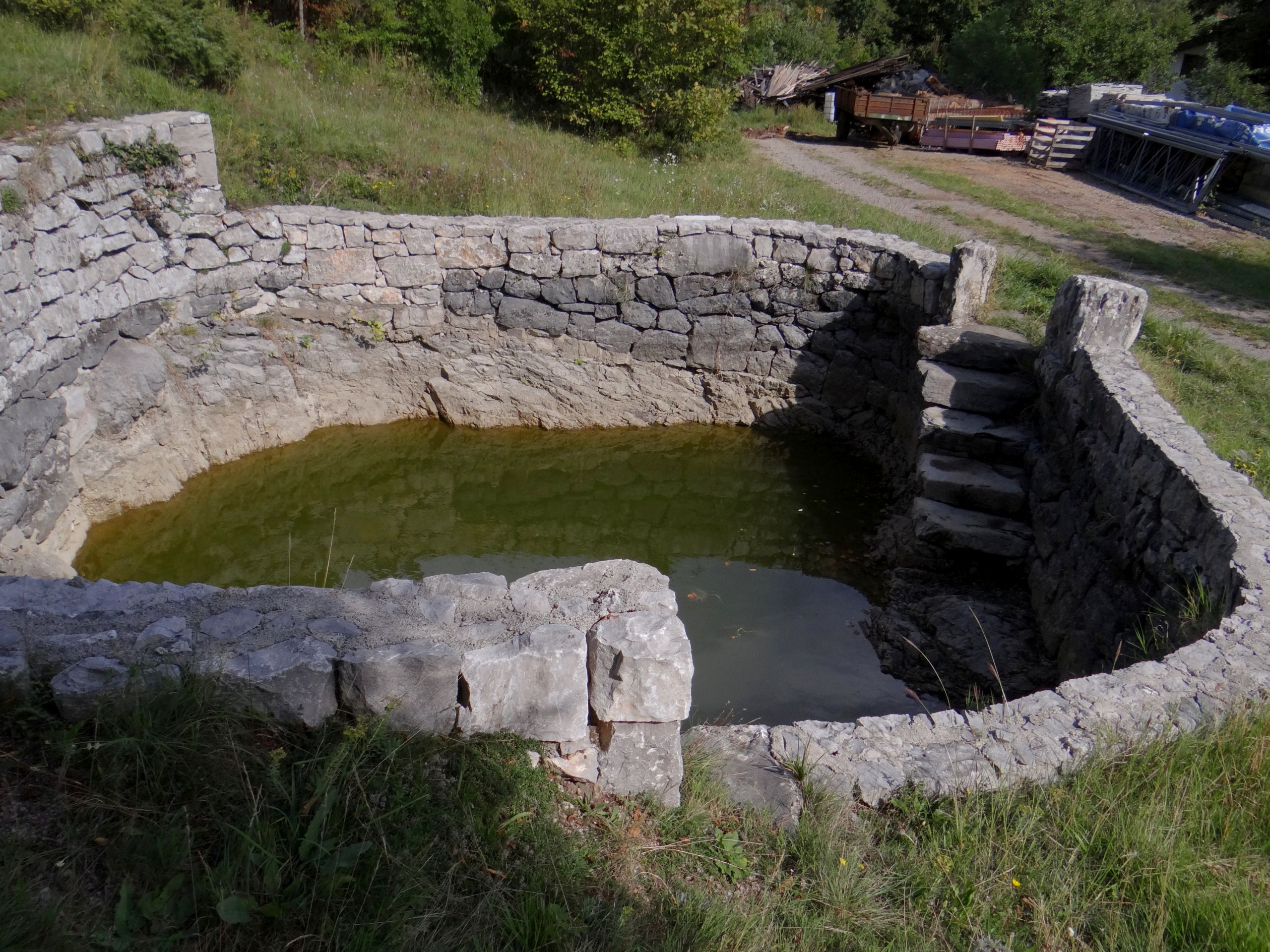
The settlement of Merče developed along this extended lowland, which has been an important traffic corridor. The old Divača-Trieste road and the Southern Railway (Vienna-Trieste), built after 1850, pass by, as well as a branch of the current Divača-Fernetiči motorway. The settlement lies in an area made up of various carbonate rocks. The northern part is less permeable, with greater karstification taking place towards the south, and with it, a higher density of sinkholes and increased cavernosity. Such information is essential to understand the way terraces are supplied with water. These days the area has no surface watercourses, but at the end of the 19th century, the Štirnca spring, which had hardly satisfied the village’s water needs, originated on the north-western slope of the nearby Prnji hill (503 m). It flowed to the north, into a central basin below the village, towards the main terraced area, or the area of the most intensively used terraces; all livestock routes to the more remote grazing terraces also passed by. An earthquake that hit Ljubljana in 1895 also caused the stream to dry up at great depth. These days, that memory lingers at an altitude of 421 m by the preserved gap and the walled pond below. The locals had already lain a livestock supply pipe from the Padež-Sežana-Trieste railway water pipe, which was built in 1857 (Mohorič 1968, Čehovin 1968). After the well dried up, they became reliant on rainwater. It was collected in wells, six of which are still in use today. In 1898, an even larger 300 cubic metre water reservoir was built to collect water flowing down from Ščenetnik Hill (253 m), in the 1920s a pool was built below Planina, also known as Gabrovec Hill (448 m). This was intended to supply the inhabitants, and any water that seeped into the lower pond was used for livestock. Since 1984, the Brestovica water supply system has been providing water to the settlement (Škrinjar, Kristan 1998).
The settlement of Merče (391 m) is only 12 km from the coast of the Gulf of Trieste as the crow flies. It has a modified, hinterland sub-Mediterranean climate (Ogrin 1996) with greater and better distributed precipitation than at the coast (Komen, 1645 mm). Despite the mild conditions, winter temperatures here can be very low. Warm sea air alternates with cold inland air intrusions. Cold bora winds blow frequently, and there is possibility of snowdrifts and sleet (Rejec Brancelj 1998, Mihevc 1998). The long vegetation period and the agricultural season allow grapevines to grow, but due to the proximity of the Dinaric Mountain barrier, this is its absolute limit of growth towards the interior.
The altitude of the lowlands in the north is about 360 m. This is the first condensed area of terraces. South of the road and the railway there is a larger karst basin with its bed at an altitude of 380 m. Most households are tightly clustered together on its eastern bank.
The gradually sloping banks of the basin are terraced. The terraces also extend over Ščenetnik hill towards the neighbouring village of Plešivica to the east and continue up the steeper slopes of all the hills surrounding the central basin. The relative heights of these elevations amount to several tens of metres, 170 m at most, with absolute heights reaching elevations between 450 and 570 m. The highest elevations are in the west, on the border with Sežana (Zidovnik, 570 m).
Due to the more favourable lithology and soil composition, and less inclined slopes, the terraces are concentrated in the northern half of the settlement area. They were formed gradually. The villagers first terraced the immediate surroundings to the households, the area below the transport axis and the less sloping land on the border with Plešivica.

As grazing areas began to run out, the terraces spread to increasingly remote and steep land. They were built by the shepherds, who put their time to good use by collecting stones to build the walls, while at the same time permanently securing their own grazing areas.
If the slopes of the terraces were made from earthworks, the terrace would slip downwards with each ploughing. As a rule, a terrace is the property of the upper owner. Otherwise, on Kras plateau the terrace banks are mostly rocky; they have a dry wall construction or, as the locals call them, dry stone walls. They are from half to one metre in height. The walls between the plots are taller than those between the terraces, and the tallest, at two-metres, and strongest are those that follow the main village tracks to the former pastures. They protected the neighbouring fields or crops from livestock incursions.
Due to the diverse relief, the terraces vary greatly in form. Their length, width and height were adapted to the shape of the surface: the length and width of the hill, basin, sinkhole and slope. The course may wind, the sides do not necessarily run in parallel, sometimes the shape bends out, at other times it is fan-shaped. Terraces vary according to land use and intensity of use. Those intended for vegetables, crops and fruit trees were usually narrower than others intended for cereals, meadows and pastures. The lengths of the terraces range from a few tens of metres, up to 100, 150 m, and widths up to 30 m and greater. The longest, 300-metre terraces, with maximum width of 15 to 20 m, e.g. the eastern foothills of Ščenetnik, and the narrowest are those found on the steepest slopes (eastern slope of Zidovnik, western slope of Ščenetnik, southern slope of Hrib). They measure only 5 to 6 m in width, some vineyards even less. The most extensive irregularly-shaped terraces can be seen southeast of the central basin, in a less sloping area between Prnji and Ščenetnik hills. The terraced areas were named after the owners (e.g. Kariževe njive/Kariž’s fields), after the location (Nad Gabrovcem/Above Gabrovec, Dolenji vrt /Lower garden), Nad brajdami /Above vineyards, Nad Šircem/Above Širec …) or what was being cultivated (Brajde/Vineyards, Lesana/The woods).
Accessibility to the terraces is highly varied. The most remote hilltop terraces were only reachable by livestock, and all terraces intended for agriculture, fruit growing, and meadow farming were accessible by cart, and later by motorised tractor. From the village there are some main power grid lanes, from which steeper cart tracks split off, leading to individual plots or terraces. A single point on the cart track gives access three stepped terraces on the left and to three on the right.
The building elements of the walls that protect, support or mark the terrace boundaries are particularly well made. Access to the terrace is through a space in the wall, the so-called vrzela, i.e. a gap, bounded by two large upright stones anchored to the ground that prevent the wall from collapsing due to the wheel axles getting stuck on the edge.
They are called gap stones, also portal stones, and are splayed at the top, leaning towards the wall. The drywalls include several other interesting features, e.g. stone steps to cross over the wall, or specific ground drainage openings every few metres, through which flowing water flushed manure from the livestock track to the adjacent lower field terraces. Walnut trees were usually planted below the opening to catch (the flowing) nutrients. Nothing was left to chance; everything was thought out to the last detail.

Walls, therefore, had many functions (Panjek 2015): in addition to piles of loose stone, they were a dumping ground for excess stones, demonstrated ownership of land or marked the plot of a particular owner, enclosed livestock pastures, and on the other hand protected fields, gardens and orchards from livestock, protected the soil from water and wind erosion and protected the seedlings from frost and wind, or from drying out. Grapevines were therefore often planted just behind the wall, on the south side, to make it easier to resist the bora winds.
All the Merče terraces (a total of 52 ha) are concentrated at altitudes between 350 and 450 m. Due to the slopes, stoniness, cavernosity and associated drought, we failed to find any in the southern, karstic half of the village land. The terraces are adapted to their exposure and slope; more than half of them face south, southwest, southeast, west and east, and 40% face north, northwest and northeast. Almost three quarters of the terraces are on flat ground, a fifth have a slope of 15 to 30 %, and more than 6% of the terraces are found on even steeper slopes.
Use of terraces over time
The Franciscan cadastre from the period 1818-1828 shows that the terraces of Merče had a completely different land use than they do today. As many as two-thirds were arable terraces. Even at that time, woodland covered 15% of the terraces, and more than 10 % was taken up by vineyards. Meadows and pastures accounted for more than 4 %, while inhabited buildings occupied a little less. 30 years ago, the terraces were most often used for growing vines or grain (wheat, spelt, oats, buckwheat, barley), there were many fruit trees (cherries, plums, pears, sagebrush, figs, mulberries), fodder plants and vegetables (potatoes, beets, carrots, peas, beans) and rapeseed. In the first half of the 1980s, the purchase price of wheat was very high, which encouraged its sowing. Fruit and vegetables were also bound for the Trieste market, until the Paris Peace Treaty after the Second World War. Today, wheat, potatoes and rapeseed, as well as vegetables for self-sufficiency, are grown on the greatly reduced arable land (1.6 %). 20 years ago, a combine harvester was required in the village for 2 days, but today it is only for an hour or two. Almost two thirds of all terraces are grassed overand rows of vine or fruit trees have been planted in some places.
Today, there are more orchards (1.8 %) than vineyards (0.8 %). Almost 4 % of the terraces are becoming overgrown, and a quarter are overgrown by woodland. After Slovenia’s independence and its accession to the EU, agriculture declined sharply due to greater competition. While 200 years ago there were about 300 head of livestock in the village, five mixed farms recently raised about 15 head of livestock. Since there is a shortage of stable manure today, farmers use green manure by ploughing rapeseed into the soil.
The settlement of Merče initially spread outwards on the terraces, but is now in stagnation. These days, the villagers only maintain the terraces next to their households, and they no longer build new drywalls in the traditional way. A re-bar wire mesh is inserted into concrete and lined with stones to give the appearance of a drywall. There are several reasons for the abandonment and decline of the traditional terraced landscape: the abandonment of agriculture, social transformation, an aging population, emigration, better earnings in non-agricultural activities immediately following Slovenian independence, ownership difficulties, manufacturing unprofitability, difficulties for heavy machinery. The remote, hard-to-reach terraces on the steeper hillside slopes, were the first to be abandoned. Today they are already overgrown with woodland, especially pine trees.
The woodlands of terraced areas, that were jointly owned before the Second World War, but passed into state hands after the war, are even older. The terraces on the less sloped and more distant from the main tracks have also become overgrown with shrubs. They first settle on the border wall, which are colonised by roots and covered with moss which accelerate deterioration (bioerosion). The bushes that encircle the terrace grow into trees within a few years reducing exposure to the sun, but soon take over the terrace itself.

Co-ownership is also unfavourable for the fate of terraces. Heirs are often unable to agree on how to manage them, which is reflected in abandoning work, maintenance and (later) decay of the walls. Only a few individual locals are aware of the importance of terraces and respect the effort and knowledge of their ancestors. They never go past a stone that has fallen out of a dry stone wall without picking it up and returning it to where it belongs. Most, however, are unaware that it is part of a cultural heritage that is slowly disappearing. There is also a noticeable difference between those larger terraces that received agricultural subsidies from European funds, and other terraces. In fact, the owners only mow the terraces for which they receive a subsidy, so narrower terraces, for which maintenance makes no sense, are doomed. This example proves the dependence of preserving the cultural landscape on bureaucratic measures after the terraces are no longer maintained for their primary, i.e. agricultural activity. The disadvantage of such policy is that the terraced landscape is only partially preserved, and that even if support covers material costs, it does not cover labour costs. Baling and bale sales provide the farmers with a small additional income.
Terraces as heritage
Terraces were recognized as a global heritage relatively recently, as the first terraces were only inscribed on the UNESCO list in the late 1970s. Slovenia has lagged slightly behind in recognizing terraces as heritage. Although individual municipalities in Slovenia have tried to protect the terraced areas, even at the time of UNESCO’s first recognition of terraces, this was more of a wish than a serious attempt. Inclusion in a nature park at the municipal level was not enough to protect and preserve them. However, in this case it was the youngest terraces from the 1950s, created due to the post-war intensification in winegrowing. Immediately following denationalisation, an extensive process of returning them to their original condition was initiated, as the owners considered the existing arrangement of terraces to be impractical. They could not come to terms with their aesthetic value (Pipan 2017).
Recognition of terraces as heritage at UNESCO and the establishment of the International Association of Terraced Landscapes ITLA 2010 has accelerated interest within scientific and professional circles, especially in Slovenia among geographers, architects, landscape architects, ethnologists, archaeologists and agriculturalists. The result of their work is also about current efforts to nominate the Goriška Brda terraces for inclusion in the UNESCO World Heritage List. The most important shift in recognizing terraces as heritage is likely to occur when terraces are taken up by society as a whole, with owners and managers, government bodies, businesses and communities taking their share of responsibility. In any case, the consequences of decades of indifference will be difficult to remedy.
Not only is knowledge about the construction of terraces, drywalls, use of terraced land, their protection, maintenance and water supply hardly passed on, or down the generations, but it is rapidly disappearing.
Why should we preserve terraced cultural landscapes?
Finally, the question of how and why to preserve the cultural landscape of the terraces so that they retain useful value, as well as aesthetic and experiential appeal? One of the possible routes is a focus on sustainable tourism, especially within selected settlements such as Merče, where the terraced landscape is more distinctive than is usual on the Mediterranean plateaus. The Merče area not only boasts a well-finished terrace system and related exceptional knowledge and skills, but there are also a number of natural and cultural attractions in the village and its surroundings that could be included in a tourist offer. These are the components of the karst natural landscape, karst rocks, underground caves, abysses, climbing walls, dolines and collapsed dolines, diverse flora and fauna, and, in addition to terraces, also other components of the cultural landscape – archaeological sites, the churches of St. Andrew and St. Maria, karst village or houses, stone shepherd huts, wells, ponds, and various stonemasonry products. There are also possibilities to reintroduce old terrace culture, the revival of local cuisine and bolstering self-sufficient farming.
Of course, not all endangered cultural landscapes can be preserved, nor does that make sense. Change is an inevitable part of life, including heritage. The solution is reflected more in the selection of representative areas, which are valuable for their message in terms of food production methods, water management and maintaining stability of the land and of biodiversity. The settlement of Merče, as a prominent example of a terraced landscape in the area of the Mediterranean plateaus, is certainly one such area. Some possible criteria are mentioned by geographers (Kladnik, Šmid Hribar, Geršič 2017b). Finally, let’s answer the question of why terraces need preserving. Adaptation of terraces to natural conditions, their design, layout, use for various purposes, their equipment and connection with water resources reflect humankind’s exceptional ability to observe, knowledge, ingenuity, sacrifice and a sense of streamlining work. They reflect human activity, its creative wisdom and concern for sustainable development, much older than the modern concept of sustainability.
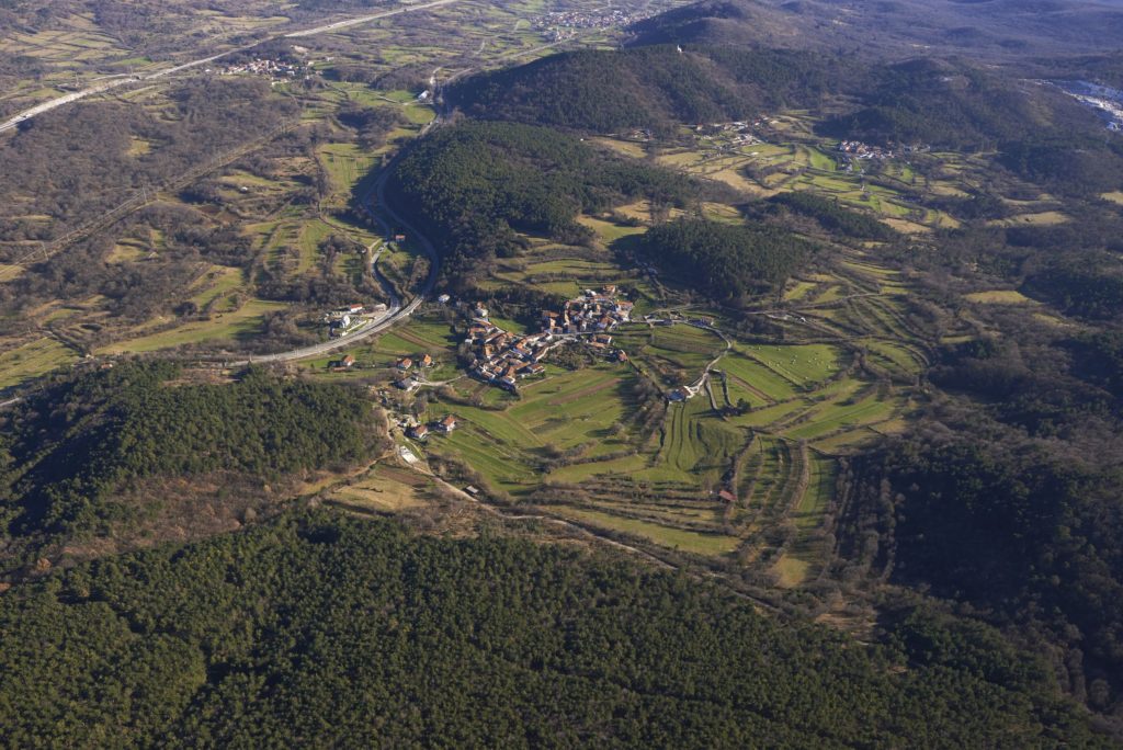
Panoramic view of Merče from the west. To the rear right is the village of Plešivica, and to the left is the flat valley with the traffic corridor and settlements of Žirje and Povir. Photo: Matevž Lenarčič, 2015. 
The pond, which was built in the 1920s, is fed from below Planina or Gabrovec Hill (448 m). This supplied the inhabitants with drinking water, and from here the water trickled down to a lower pond for livestock. Photo: Maja Topole, 2015. 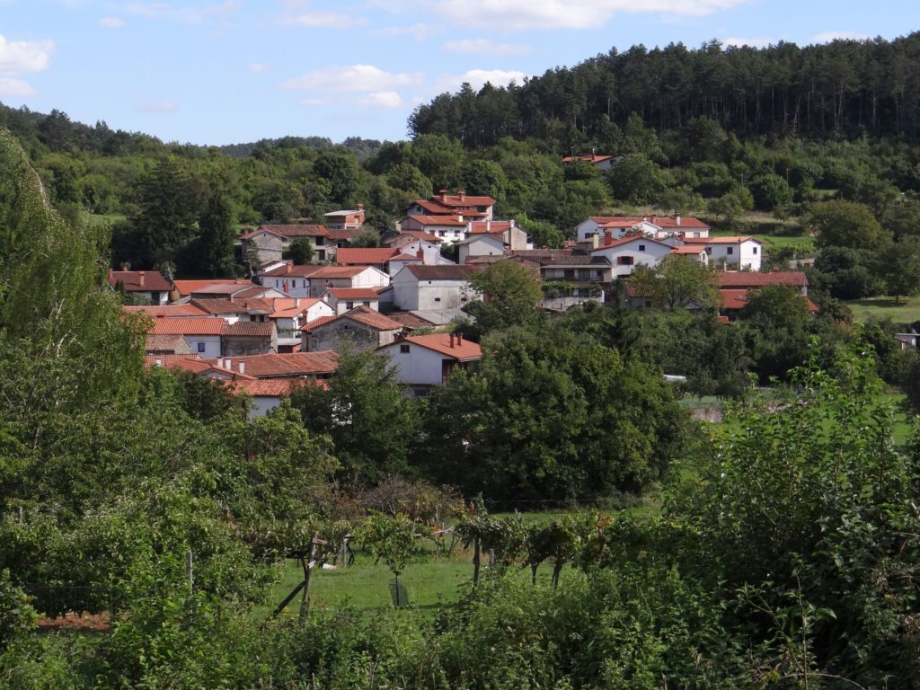
Most of Merče’s households are tightly clustered on the eastern bank of a karst basin. Photo: Maja Topole, 2015. 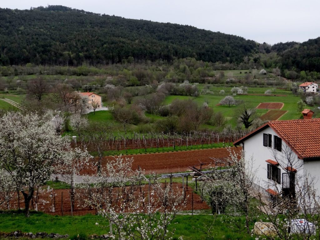
The most distinctive terraced village area at the foot of Zidovnik hill (570 m) is still noticeable in the spring, before the tree leaves start to grow. Photo: Maja Topole, 2014. 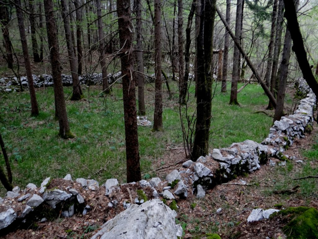
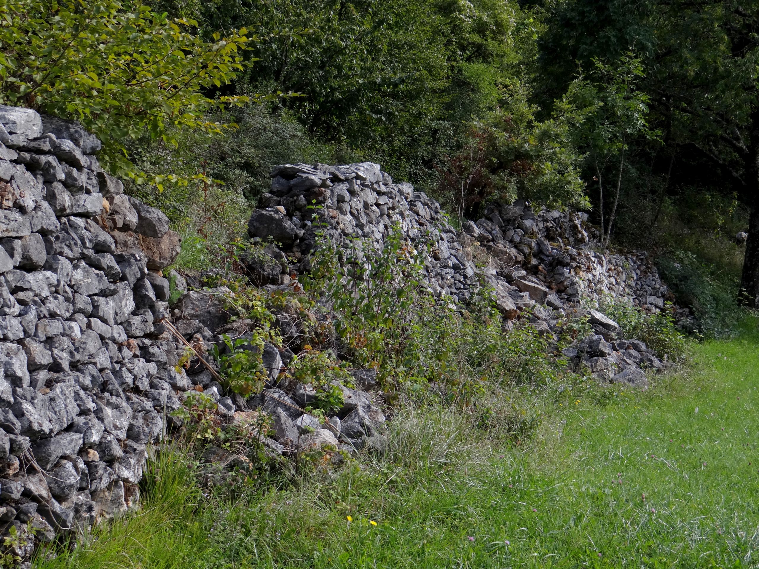
The overgrown interior walls of a livestock enclosure some distance from the settlement of Merče. Photo: Maja Topole, 2014. 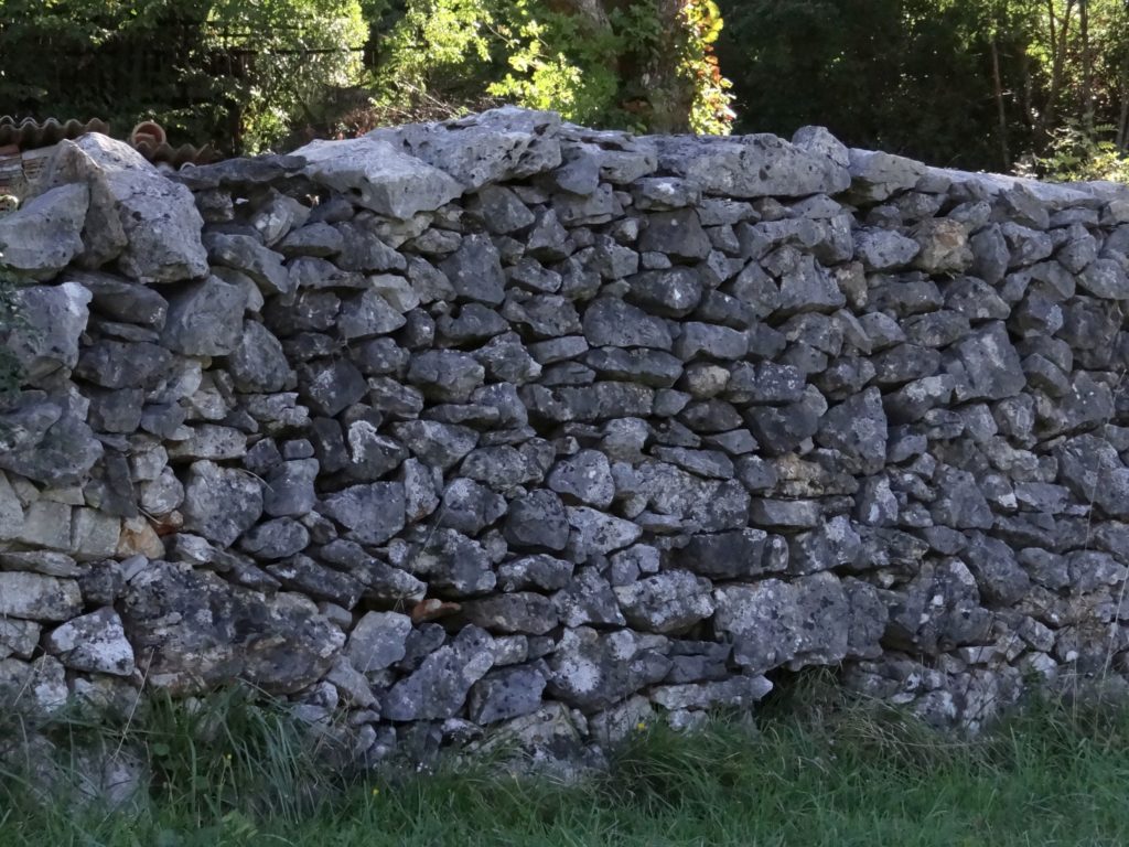
The main livestock tracks to remote pastures were protected by higher dry walls to protect neighbouring fields from livestock incursions. Photo: Maja Topole, 2015. 
A vrzela, the entrance to a walled terrace, was closed off by a wooden barrier whenever cattle were passing by. Photo: Maja Topole, 2015. 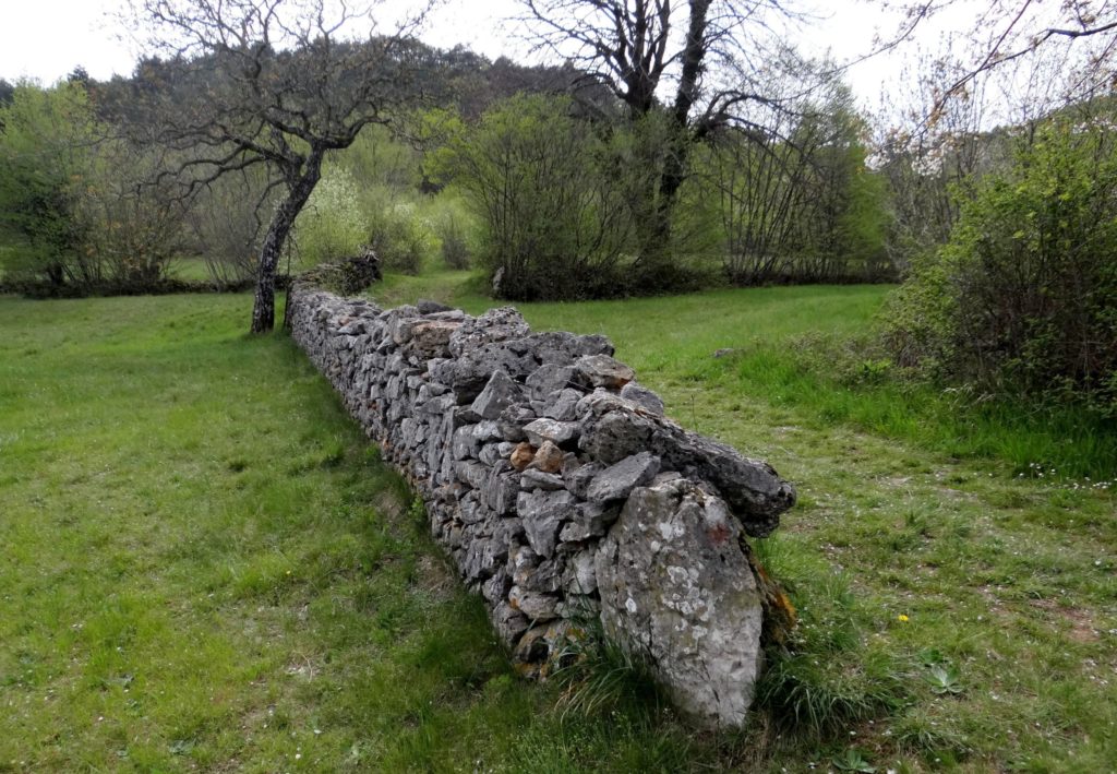
Stronger wall along the livestock track with a portal stone that prevents the wall from collapsing. Photo: Maja Topole, 2014. 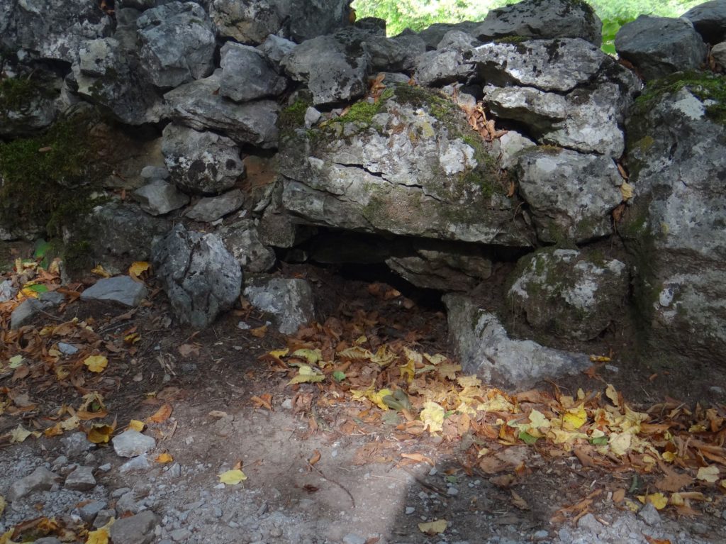
Ground drainage openings every few metres, through which flowing water flushed manure along the livestock path to the adjacent lower terraces Walnut trees were usually planted below the opening to catch nutrients. Photo: Maja Topole, 2015. 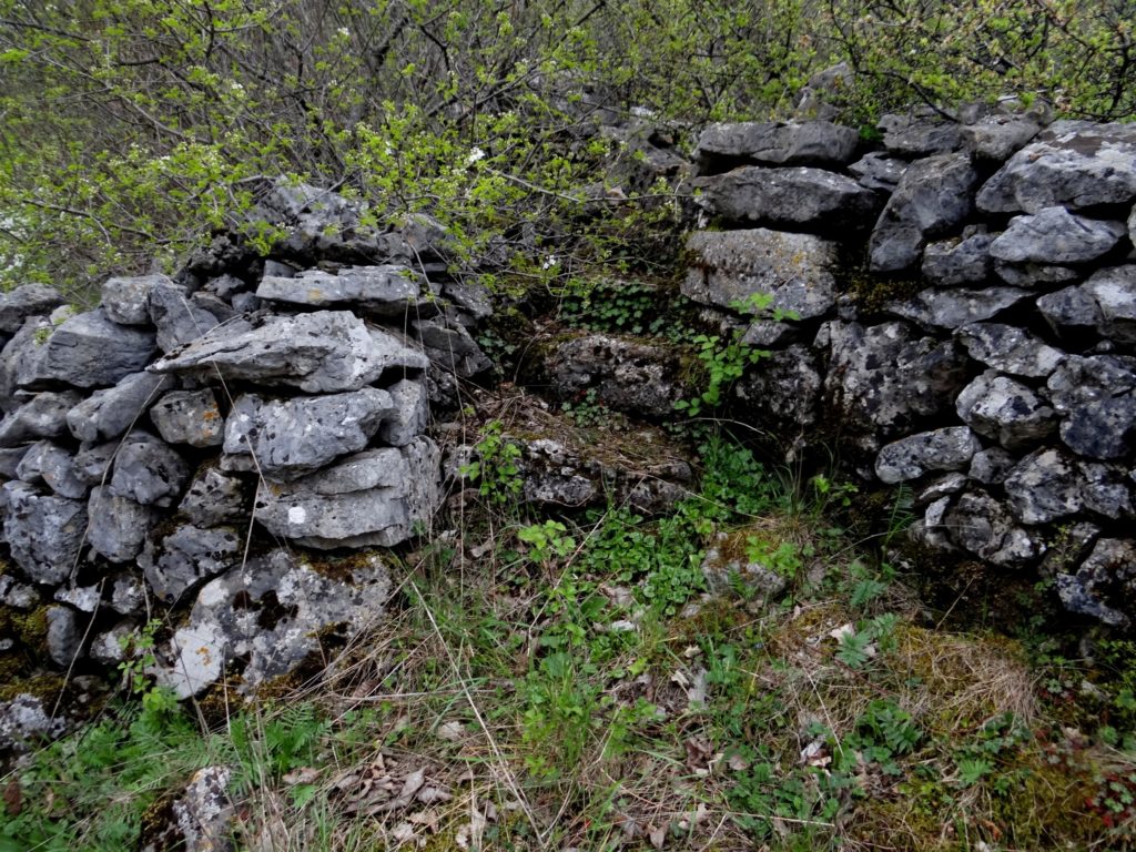
Stone steps to cross over the wall. Photo: Maja Topole, 2014. 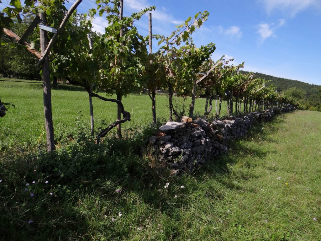
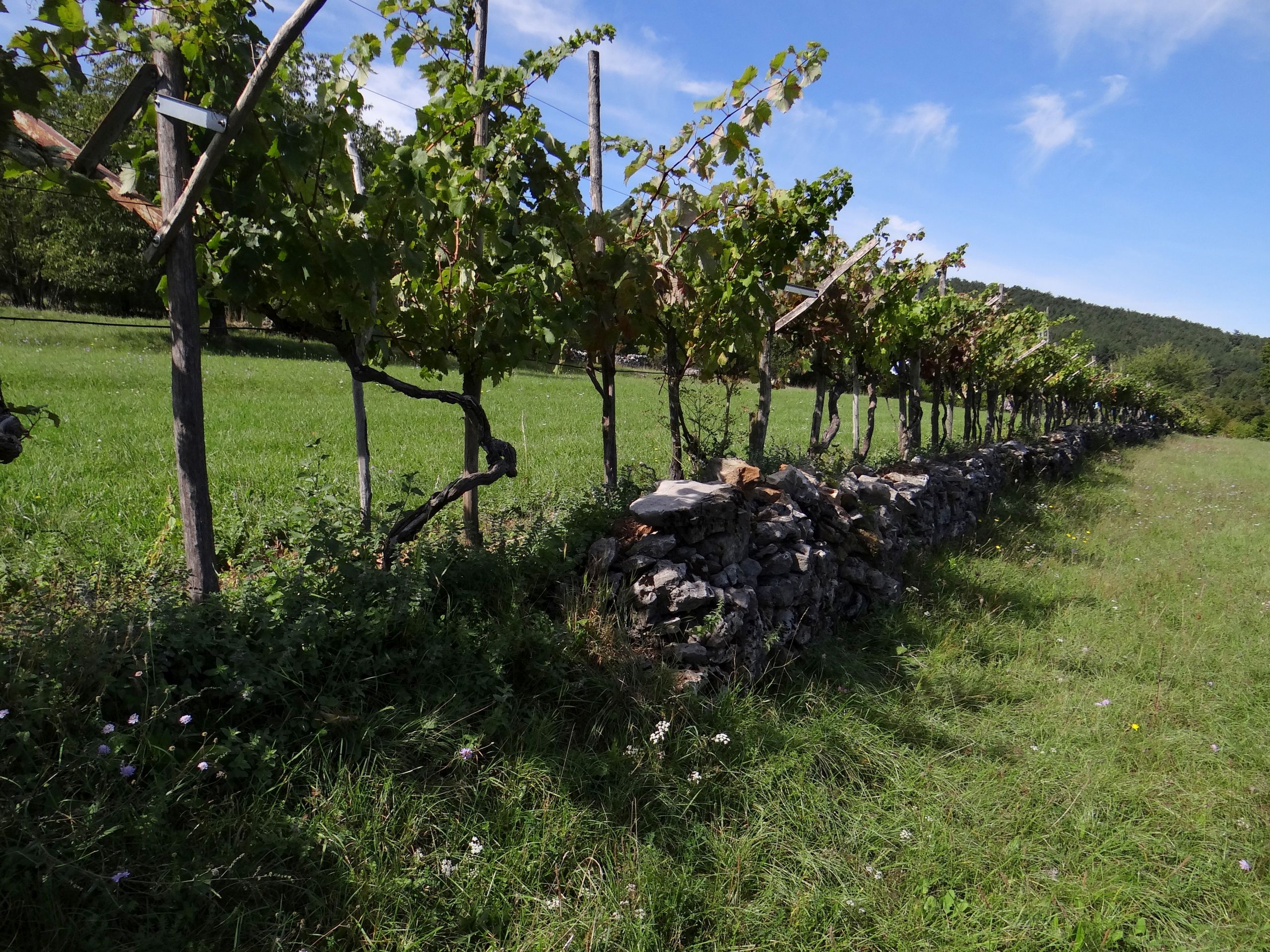
The grapevine is planted close to leeward, south side of the wall to protect it from frost and drying out. Photo: Maja Topole, 2015. 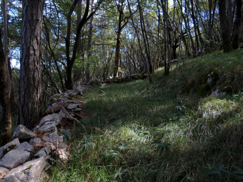
Former pasture on the slope of a remote hill. Dry walls were a dumping ground for crushed stones, used to build the terrace bank, marked a property or plot, fenced off pasture and protected livestock, while protecting the soil from wind and water erosion. Photo: Maja Topole, 2015. 
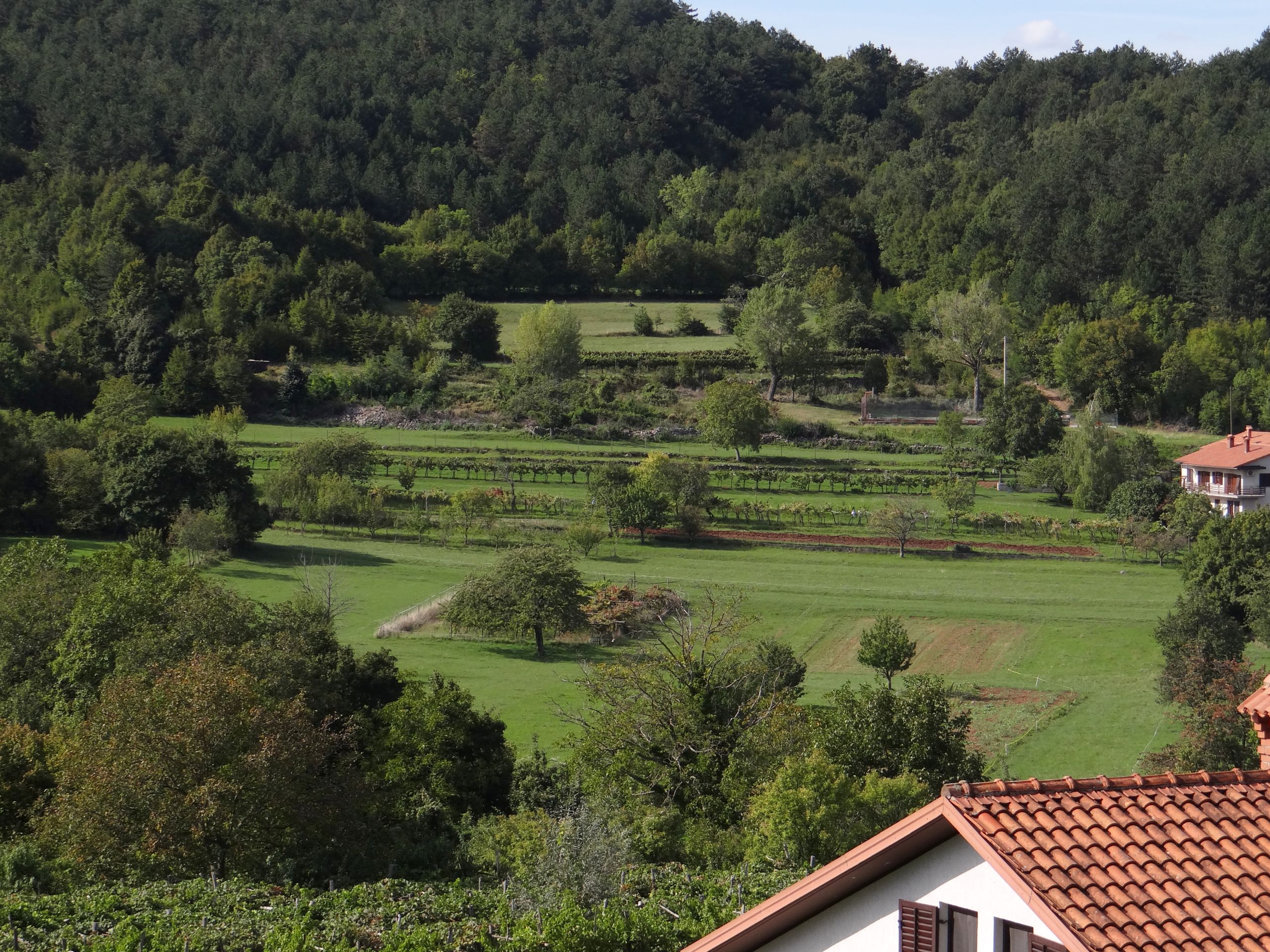
Today, the terraces are grassed over or extensively cultivated. Photo: Maja Topole, 2015. 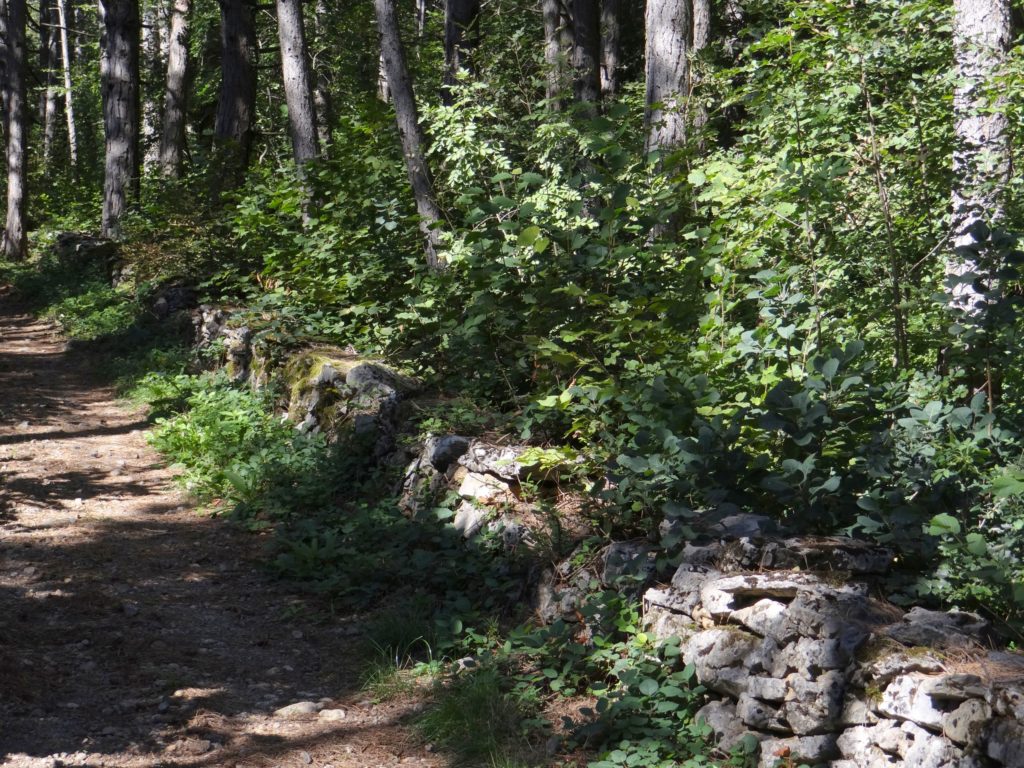
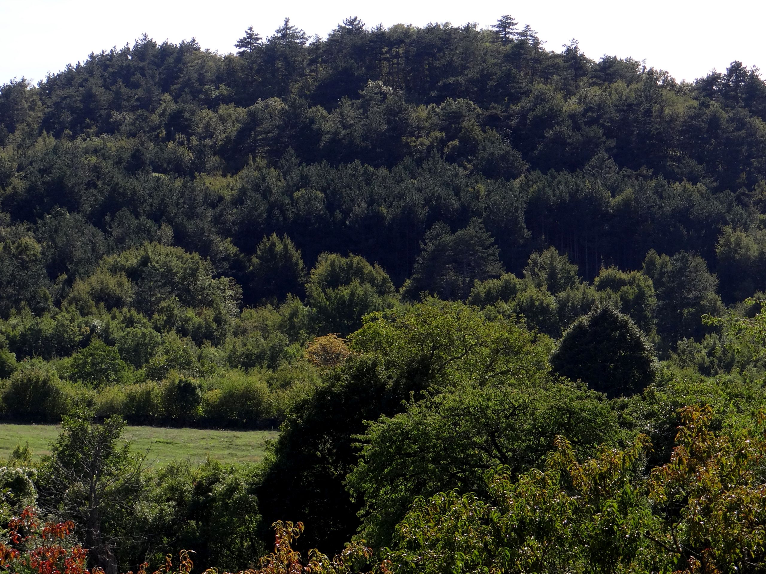
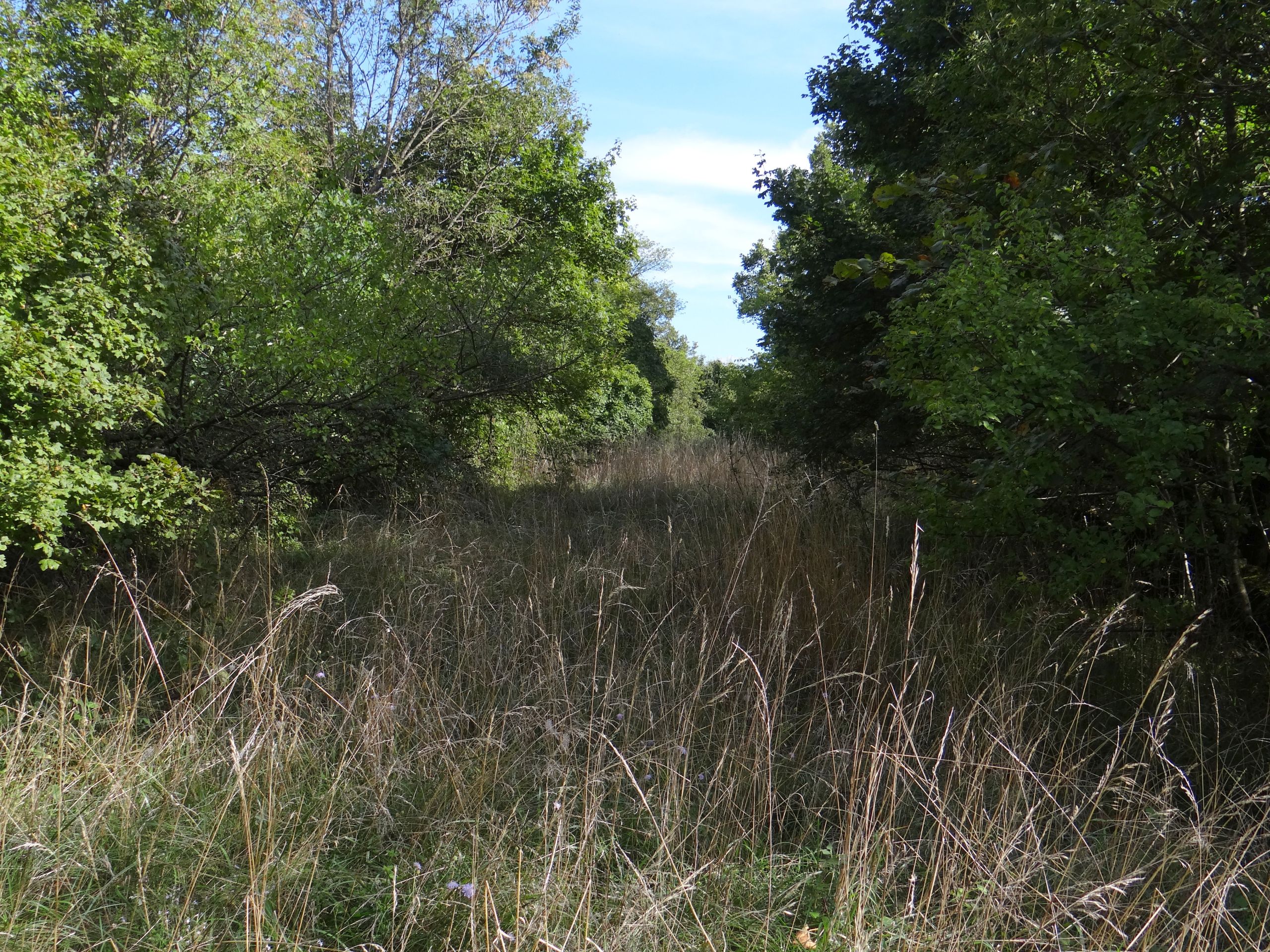
The terraced vineyards on steep slopes have long been abandoned, so the terraces have become overgrown with mature pine trees. Photo: Maja Topole, 2015. 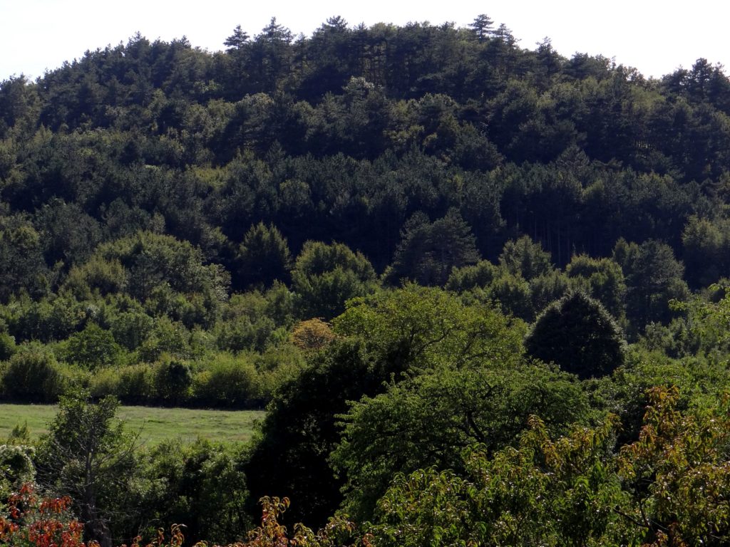
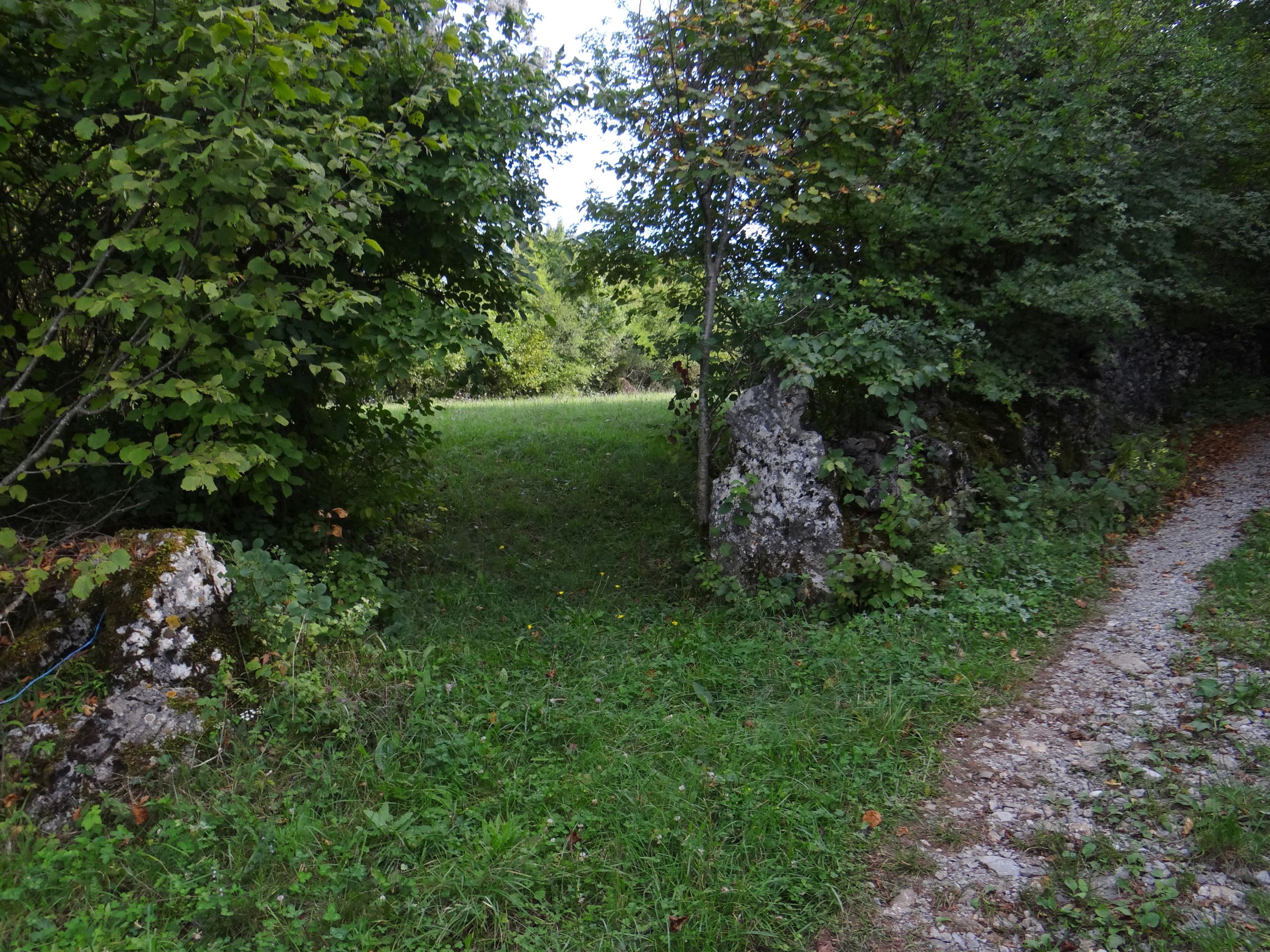
Views of the elevation, lead us to suspect that terraced slopes are hidden beneath the woodland. Photo: Maja Topole, 2015. 
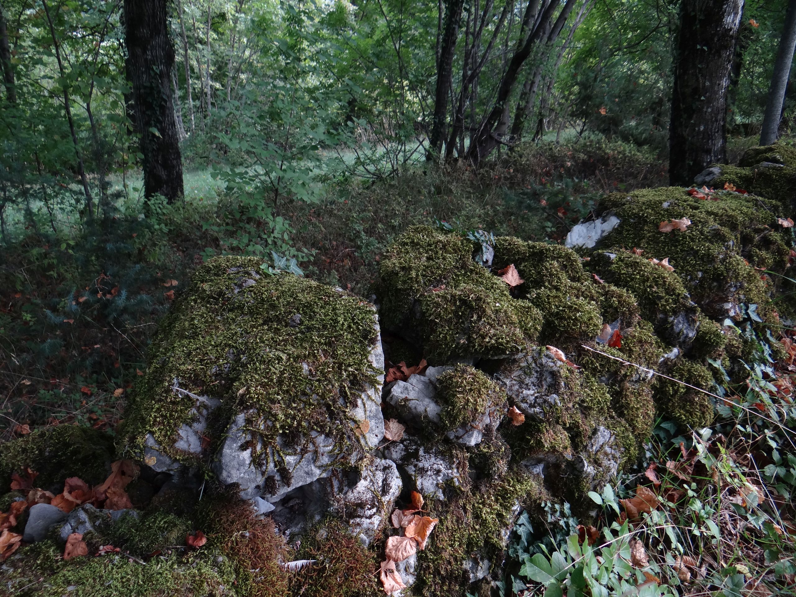
Unmaintained walls are quickly overgrown by moss, shrubs, and trees; bioerosion accelerates wall decay. Photo: Maja Topole, 2015. 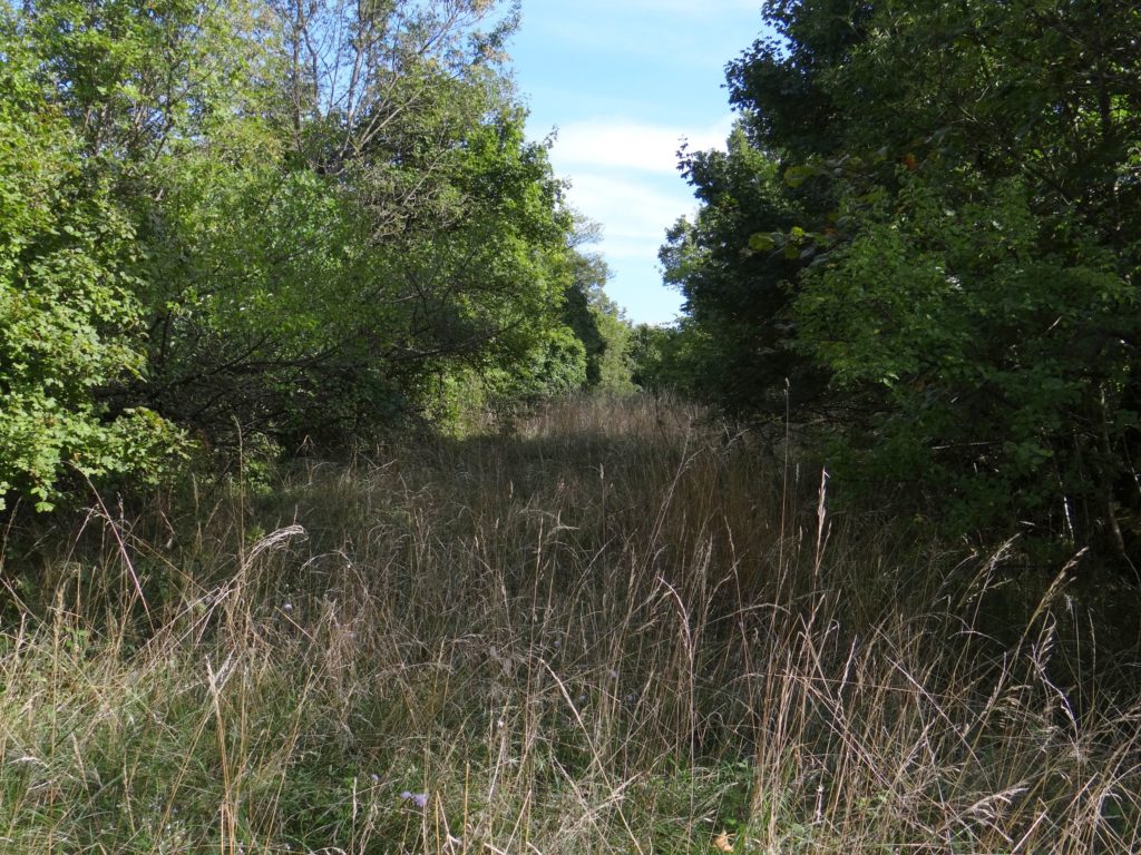
The narrower terraces do not receive support from European funds, so they are no longer mowed. The terrace is shaded by trees, and soon trees will take over the entire terrace. Photo: Maja Topole, 2015. 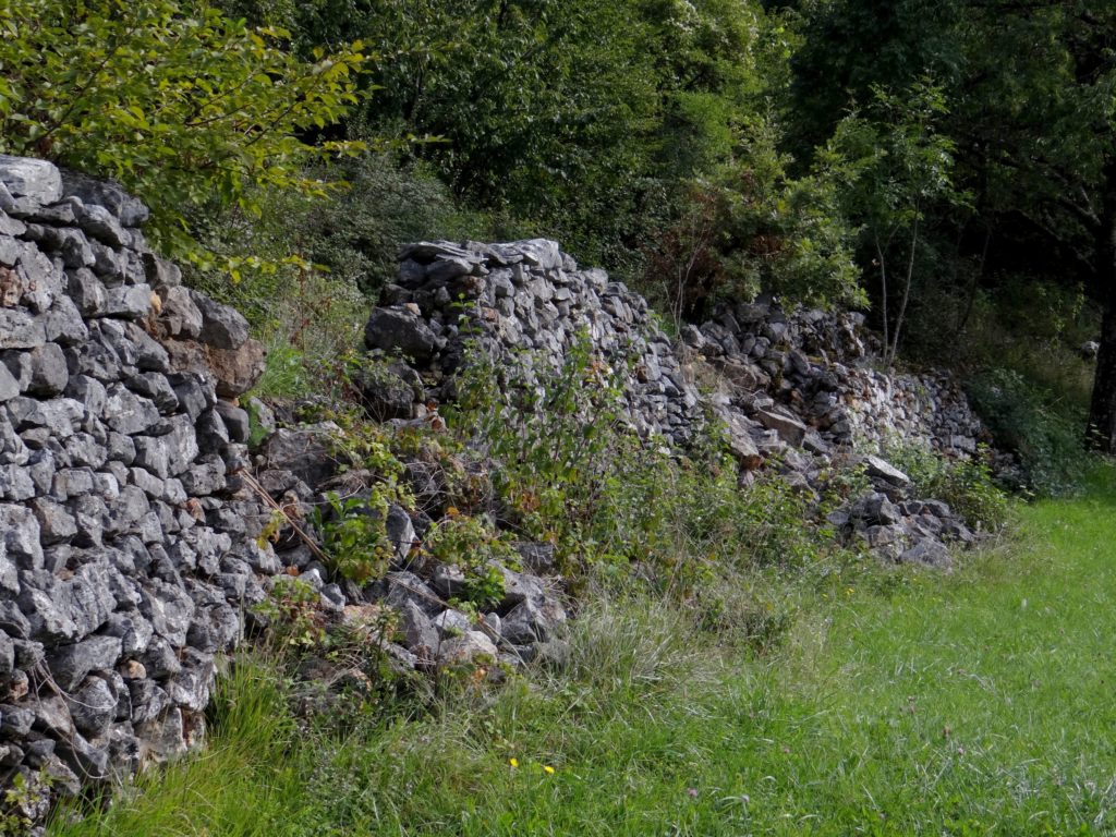
Sad view of a crumbling dry wall. Photo: Maja Topole, 2015.


References
- Ažman Momirski, L. 2019: Slovenian Terraced Landscapes. In: Varotto, M., Bonardi, L., Tarolli, P. (ed.) 2019: World Terraced Landscapes: History, Environment, Quality of Life, p. 45-62. Environmental History 9. Florence.
- Ažman Momirski, L., Kladnik, D. 2015: Terasirana pokrajina v Brkinih. Acta geographica Slovenica 55-1. DOI.
- Čehovin, S. 1968: Merče. Krajevni leksikon Slovenije I, p. 323‑324. Ljubljana.
- Divača 164, 028-4-2. Državna topografska karta RS 1 : 25.000. Ljubljana, 1996.
- Honghe Declaration 2010, (3. 4. 2020).
- Interview 1 2014: Dean Kariž, local and representative of the agrarian community of Merče. Merče.
- Interview 2 2014: Darij Volk, local and terrace owner. Merče.
- ITLA Background, (3. 4. 2020).
- Kladnik, D. 2016a: Terasirane pokrajine in Honghejska deklaracija. Terasirane pokrajine, p. 4-7. Ljubljana.
- Kladnik, D. 2016b: Terasirane pokrajine v Sloveniji. Terasirane pokrajine, p. 70-75. Ljubljana.
- Kladnik, D., Komac, B., Zorn, M. 2016: Terasirane pokrajine v Evropi. Terasirane pokrajine, p. 51-69. Ljubljana.
- Kladnik, D., Kruse, A., Komac, B. 2017a: Terraced landscapes, an increasingly prominent cultural landscape type. Acta geographica Slovenica, 57-2, 73–81. DOI.
- Kladnik, D., Šmid Hribar, M., Geršič, M. 2017b: Terraced landscapes as protected cultural heritage sites. Acta geographica Slovenica 57-2. DOI.
- LIDAR ARSO, 2015.
- Mohorič, I. 1968: Zgodovina železnic na Slovenskem. Ljubljana.
- Odlok o razglasitvi in zavarovanju naravnih območij in spomenikov narave na območju občine Ljutomer. Uradne objave 14. Ljutomer, 1976.
- Odlok o razglasitvi naravnih znamenitosti v občini Ormož. Uradni vestnik občin Ormož in Ptuj 37. Ptuj, 1992.
- Ogrin, D. 1996: Podnebni tipi v Sloveniji. Geografski vestnik 68. Ljubljana.
- Panjek, A. 2015: Kulturna krajina in okolje Krasa. Koper.
- Pipan, P., Kokalj, Ž. 2017: Transformation of the Jeruzalem hills cultural landscape with modern vineyard terraces. Acta geographica Slovenica 57-2. DOI.
- Podatki SURS in GURS o naseljih SR Slovenije, (3. 4. 2020).
- Rejec Brancelj, I. 1998: Kras. Slovenija, Pokrajine in ljudje, p. 234‑244. Ljubljana.
- Strokovne zasnove varstva kulturne dediščine za območje Občine Sežana, Zavod za varstvo kulturne dediščine Slovenije, Območna enota Nova Gorica. Nova Gorica, 2008.
- Škrinjar, P., Kristan, S. 1998: Kraški vodovod Sežana, Zgodovina podjetja 1948-1998. Sežana.
- Škrinjar, P. 2015: Kraški vodovod Sežana, (13. 11. 2015).
- Šmid Hribar, M., Geršič, M., Pipan, P., Repolusk, P., Tiran, J., Topole, M., Ciglič, R. 2017: Cultivated terraces in Slovenian landscapes. Acta geographica Slovenica 57-2. DOI.
- Unesco World Heritage List, (24. 3. 2020).
- Varotto, M., Bonardi, L., Tarolli, P. (ed.) 2019: World Terraced Landscapes: History, Environment, Quality of Life. Environmental History 9. Florence.
- Zemljevid tipov kamnin. Geografski inštitut Antona Melika ZRC SAZU, 9. 12. 2012. Ljubljana.
footnotes
- According to architects and geographers, terraces add value to the cultural landscape, but only remain so if they are suitably maintained (Ažman Momirski, Kladnik 2015). We know of examples for protecting terraces within a nature park (Decree 1976, Decree 1992), however that protection was executed with no specialist basis and remained only on paper (Pipan 2017). Even today, several examples of cultural terracing are listed in the Register of Immovable Cultural Heritage of the Republic of Slovenia, but as a characteristic part of the cultural landscape, and not as a terraced region per se (e.g. registration numbers 7867, 9340, 15090, 18465, 21627, 24422, 28262 ). It is important to formulate criteria that allow a meaningful selection of terraced areas to protect, and then to actually protect them. One such proposal for criteria has been suggested by geographers (Kladnik, Šmid Hribar, Geršič 2017b).[↑]
- Using LIDAR recording or aerial laser scanning it is possible to identify the surface form beneath the vegetation cover, even overgrown terraces.[↑]